
TL;DR:
- North American beavers are environmental engineers, transforming landscapes across diverse ecosystems.
- Large-scale mapping of beaver habitats has been lacking in scientific research.
- Fairfax et al. developed a machine learning model called EEAGER to identify beaver dams using geospatial imagery.
- The model achieved an accuracy rate of 98.5% in identifying dam sites.
- The methodology can track beaver populations, monitor ecosystem changes, and aid in river restoration efforts.
- The approach can be extended to monitor other complex landforms across large regions.
Main AI News:
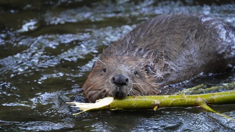
The remarkable engineering abilities of North American beavers have long fascinated scientists and environmentalists. These industrious creatures have the power to transform entire ecosystems, reshaping landscapes and leaving a profound impact on diverse environments, from the frozen tundra to arid deserts.
However, the relentless fur trading of the 17th century dealt a devastating blow to the beaver population, pushing them to the brink of extinction. Thankfully, in recent years, these thick-coated builders have been making a steady comeback. This resurgence is not only good news for the beavers themselves but also for the ecosystems they inhabit. The construction activities of beavers create vital habitats for endangered species, sequester carbon, and enhance water availability in arid regions.
Despite the ecological significance of beaver habitats, there has been a glaring absence of large-scale mapping in scientific research. The majority of identified beaver dams have been painstakingly located manually, an arduous and time-consuming task.
To overcome this obstacle and expedite beaver dam identification, Fairfax et al. have turned to the power of machine learning. Their groundbreaking work harnesses high-resolution geospatial imagery to detect potential dam complexes on a landscape and regional scale. Leveraging the Earth Engine Automated Geospatial Element(s) Recognition (EEAGER) model, a neural network trained on thousands of known beaver dam locations in aerial and satellite images, the researchers have achieved remarkable results.
In their study, the team focused on training the model to recognize dams in the western United States. Subsequently, they tested its efficacy in unfamiliar areas, evaluating its ability to accurately identify dams in imagery. Impressively, the EEAGER model achieved an accuracy rate of 98.5% in differentiating between sites with and without dams. While the model’s recall, which measures the percentage of known dams correctly identified, stood at 63%, and its precision, which measures the percentage of model-predicted dams that indeed dammed, reached 26%, the authors acknowledge the potential for improvement.
They suggest that further training in diverse regions where beavers are known to build could enhance both recall and precision. Nonetheless, the high recall rate demonstrates the model’s capability to detect a significant proportion of actual dams. The researchers also noted that false-positive dam identifications could be easily filtered manually, and many of these false positives were found in close proximity to real beaver dams.
This pioneering work carries immense implications. Not only does it facilitate the tracking of beaver populations and their overall well-being, but it also allows for a better understanding of ecosystem dynamics and presents opportunities for beaver-driven river restoration efforts. Furthermore, the methodology developed by Fairfax et al. could serve as a blueprint for monitoring other intricate landforms across vast regions.
The ability to swiftly and accurately map beaver habitats marks a monumental achievement in ecological research. By merging cutting-edge technology with the natural world, scientists are unveiling a new era of environmental monitoring and conservation. With the aid of machine learning, we can uncover the hidden secrets of our ecosystems and pave the way for a sustainable future.
Conclusion:
The application of machine learning in mapping beaver dams represents a significant breakthrough in ecological research. By automating the identification process, scientists can save substantial time and effort previously spent on manual mapping. This not only enables more extensive and comprehensive studies on beaver populations and their habitats but also opens avenues for monitoring other intricate landforms. From a market perspective, this innovation could offer opportunities for companies specializing in geospatial imagery analysis and environmental monitoring. The demand for efficient and accurate mapping solutions is expected to rise as more organizations recognize the importance of understanding and conserving our ecosystems.