TL;DR:
- A new dataset of Arctic images captured during the voyage of the USCG icebreaker Healy will revolutionize AI research.
- Lincoln Laboratory researchers installed a camera system on the Healy to develop AI tools that can analyze Arctic imagery.
- The dataset will aid mariners in safe navigation, enhance maritime domain awareness, and address national security challenges.
- Few existing Arctic imagery datasets limit the study of the region’s rapid changes.
- The CRISP system, equipped with advanced technology, will record high-quality images in extreme Arctic conditions.
- The dataset, expected to be 4 terabytes in size, will be publicly released after the USCG mission concludes.
- The release aims to enable faster progress in AI research and provide a baseline object-detection model for other researchers.
- This project has the potential to combat climate change and support AI applications in various critical domains.
Main AI News:
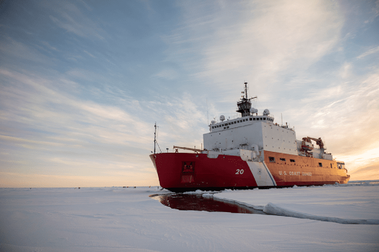
The realm of artificial intelligence is about to witness a remarkable transformation, thanks to a groundbreaking dataset of Arctic images captured during the ongoing voyage of the U.S. Coast Guard (USCG) icebreaker Healy. In a joint effort, researchers from Lincoln Laboratory equipped the Healy with an advanced camera system before embarking on a three-month scientific mission on July 11. The resulting dataset, a pioneering initiative of its kind, holds the key to developing sophisticated AI tools capable of analyzing Arctic imagery.
Jo Kurucar, a distinguished researcher from Lincoln Laboratory’s AI Software Architectures and Algorithms Group, spearheaded this exceptional project. Speaking of its significance, Kurucar explains, “This dataset not only can help mariners navigate more safely and operate more efficiently, but also help protect our nation by providing critical maritime domain awareness and an improved understanding of how AI analysis can be brought to bear in this challenging and unique environment.”
The Arctic region, amidst its rapid transformation driven by global warming and melting sea ice, has become a subject of vital importance. The opening of Arctic passages to increased traffic, including military vessels and vessels involved in illegal fishing, poses national security challenges for the United States. Additionally, the evolving Arctic landscape raises questions about its climate, wildlife, and geography.
Presently, only a handful of imagery datasets of the Arctic exist, providing limited insights into these changes. However, by utilizing an outward-looking camera on a ship, more comprehensive information can be captured, showcasing diverse angles of the environment, including other ships in the scene. These valuable images will serve as training data for AI computer-vision tools, empowering the USCG to plan naval missions more effectively and automate critical analysis. Kurucar emphasizes that AI tools can act as force multipliers, a considerable asset for the thinly spread USCG assets in the Arctic.
The Healy, the USCG’s largest and most technologically advanced icebreaker, was the perfect candidate for this ambitious undertaking. Collaborating with the USCG Research and Development Center, the laboratory research team designed the Cold Region Imaging and Surveillance Platform (CRISP), a cutting-edge system featuring a long-wave infrared camera, specially crafted by Teledyne FLIR for harsh maritime environments. The camera’s remarkable capabilities include self-stabilization during rough seas, imaging in extreme conditions of darkness, fog, and glare. It is complemented by a GPS-enabled time-synchronized clock and a network video recorder to document video and still imagery, along with GPS-positional data.
The CRISP system’s installation was not without its challenges. The team, working alongside the ship’s crew, had to make quick adjustments to the cable routes after realizing that expected access points were not readily available. Despite the hurdles, the team managed to overcome the obstacles with ingenuity, ensuring the success of this crucial project.
Upon the completion of the USCG science mission this fall, the CRISP project team aims to release the dataset to the public, which is expected to amount to approximately 4 terabytes of data. By providing this dataset to the wider research community, the goal is to facilitate the development of more advanced tools for operations in the increasingly navigable Arctic region. Kurucar stresses that this collaborative approach will foster faster and greater progress, enabling the laboratory to engage in even more cutting-edge AI applications while others make incremental advancements using the dataset.
In addition to sharing the dataset, the laboratory team is determined to offer a baseline object-detection model, which will serve as a springboard for other researchers to make strides with their own models. Ambitious AI applications on the horizon include classifiers tailored for specific objects within the Arctic scene, as well as the capability to identify and track objects across various images.
Beyond its significance in assisting USCG missions, this monumental project holds immense potential in combatting climate change by providing researchers with a powerful dataset to apply AI techniques to Arctic data. Paul Metzger, who leads the AI Software Architectures and Algorithms Group, believes this endeavor will further the group’s legacy of applying AI to address the highest-priority challenges faced by the United States, from predicting Covid-19 outbreaks to supporting the U.S. European Command in their efforts to aid Ukraine. Now, the team’s latest endeavor to harness AI for maritime awareness in the Arctic is set to create a lasting impact on the future of technology and environmental conservation.
Conclusion:
The availability of this groundbreaking Arctic image dataset opens up a plethora of opportunities for the AI market. Companies and researchers can harness this data to develop innovative AI solutions tailored to address specific challenges in the maritime and environmental sectors. Moreover, the collaborative approach of sharing the dataset will foster accelerated advancements in AI technology, leading to significant breakthroughs that can drive economic growth and environmental sustainability. As AI continues to gain momentum, the intersection of cutting-edge technology and critical global issues, like those presented in this project, will shape the future landscape of the AI market. Businesses that seize these opportunities can gain a competitive advantage by positioning themselves at the forefront of AI-driven innovation.

