
TL;DR:
- Nearly 30% of tree cover in Africa exists outside of forests, according to a groundbreaking study.
- Researchers utilized machine learning and high-resolution satellite imagery to identify individual tree crowns.
- Mapping individual trees reveals the significance of woody resources beyond traditional forest areas.
- Ignoring trees outside of forests can lead to underestimating a nation’s carbon stocks.
- The new mapping method enables the tracking of restoration efforts and the identification of areas for tree-planting initiatives.
- Access to high-resolution imagery and computing resources may limit the widespread use of this approach.
- The findings have implications for sustainable land management, restoration projects, and carbon accounting.
Main AI News:
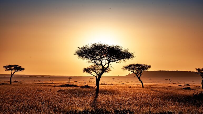
In the realm of environmental mapping, it’s crucial to look beyond the forest and acknowledge the individual trees that contribute to the larger ecosystem. Recent research published in Nature Communications reveals an astounding finding: nearly 30% of all tree cover in Africa exists outside traditional forest areas. This groundbreaking analysis, conducted by geographer Florian Reiner and his team at the University of Copenhagen, sheds light on the hidden green wealth of the continent.
By harnessing the power of machine learning and high-resolution satellite imagery, Reiner and his colleagues developed a cutting-edge approach to identifying individual tree crowns. Through meticulous manual labeling, they created a comprehensive tree-cover map for 45 African countries in 2019, capturing even the smallest woody resources.
This study challenges the conventional definition of forests, which primarily relies on the presence of a tree canopy. While trees within forests form an integral part of these ecosystems, the mapping of individual trees recognizes their significance as standalone woody resources. The implications are far-reaching, as governments and organizations often overlook these resources in their decision-making processes and fail to account for their substantial carbon stocks.
The ramifications of this oversight are particularly evident in Rwanda, where Maurice Mugabowindekwe, co-author of the Nature Communications paper, recognizes the value of granular information on trees. Rwanda, under the Bonn Challenge, aims to restore a staggering 2 million hectares of land, representing nearly 80% of its total area. The newfound ability to track restoration efforts outside forested areas empowers the nation to engage millions of small cultivators in the campaign, identifying areas for tree-planting initiatives and addressing encroachment issues.
The research team employed a groundbreaking methodology, utilizing a constellation of satellites provided by U.S.-based company Planet Labs. With access to approximately 200,000 images, they trained a machine learning-based technique to identify tree crowns, combining remote sensing with advanced data analysis. However, the high cost and computing requirements of this approach may limit its accessibility.
Mugabowindekwe’s previous work using a similar model showcased the potential of this technique. By manually labeling nearly 100,000 trees in Rwanda, they were able to estimate the presence of 350 million trees across the country. To ensure the accuracy of their findings, the team validated their results by comparing them to estimates derived from traditional methods such as light detection and ranging (LiDAR) and unmanned aerial vehicle (UAV) imagery.
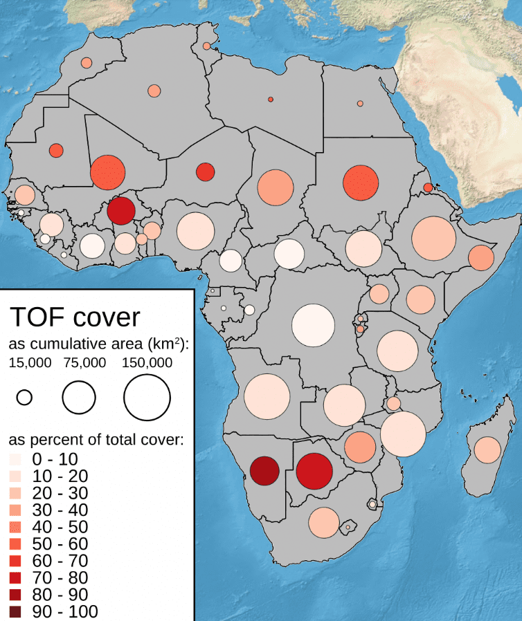
Remarkably, the study highlights that existing maps, relying on moderate-resolution data, fail to distinguish these “trees outside forests” accurately. Approximately 30% of Africa’s tree cover remains unrecognized in widely used land-cover maps. These trees, found in agricultural fields, grazing lands, urban settlements, and roadways, provide essential resources for farmers and communities. Even a small cluster of trees can yield valuable fertilizer, fruits, and firewood.
The implications extend beyond individual nations, as several African countries—Botswana, Burkina Faso, Eritrea, Libya, Mali, Namibia, Niger, Mauritania, and Sudan—have nearly half of their tree cover located outside designated forest areas. By incorporating this previously unaccounted resource into global forest maps, Reiner and his team are revolutionizing our understanding of Africa’s green landscape.
Looking ahead, the researchers plan to develop annual maps using this groundbreaking technique, enabling consistent monitoring of changes in tree cover. Although the current 3-meter resolution provides a significant improvement, capturing smaller trees remains a challenge. This limitation may hinder the monitoring of restoration projects in their early stages. However, at a higher resolution of 0.25 meters, individual trees in dense closed-canopy forests could be identified, allowing for even more comprehensive monitoring efforts.
Todd S. Rosenstock, an expert in agroforestry research, commends the progress made by this study in our ability to measure and monitor trees in diverse landscapes. However, he emphasizes the importance of ensuring accurate tree counts moving forward. The potential of this novel approach goes beyond tree detection—it holds the key to estimating carbon stocks and understanding the role of trees in mitigating climate change.
The research team’s findings have significant implications for Rwanda, where nearly half of the aboveground carbon stocks are located outside designated forest areas. Martin Brandt, an expert in this field, collaborates with the team to expand their machine learning-based technique and generate biomass and carbon storage data for a wider region.
Source: Conservation news
Conclusion:
The revelation of Africa’s extensive tree cover beyond forests signifies a paradigm shift in mapping approaches. By utilizing advanced technology and machine learning, we gain a more accurate understanding of the continent’s green resources. The identification of individual trees highlights their importance as valuable woody resources, providing essential benefits to farmers and communities. This newfound knowledge can guide restoration efforts and enable informed decision-making for sustainable land management.
However, the limited accessibility of high-resolution imagery and computing resources poses challenges for widespread implementation. Nonetheless, this research sets the stage for improved carbon accounting and underscores the need for a comprehensive understanding of Africa’s diverse landscapes in the market.